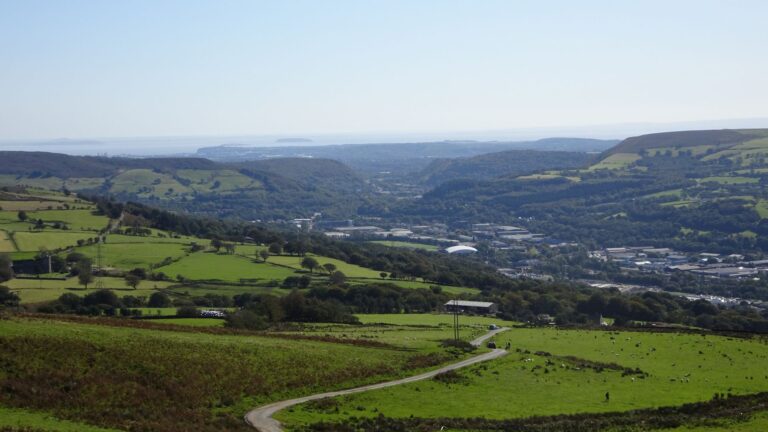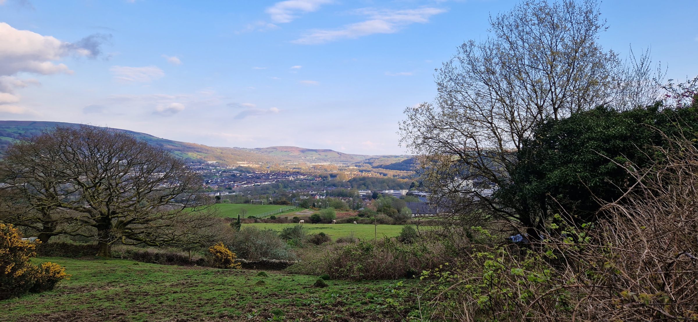
Mynydd Eglwysilan is the big, open hill north of Rhydyfelin, between the Taff and Rhymney valleys. At around 383 metres, its trig pillar marks the highest point on the Pontypridd Circular walk, and you can reach it on foot straight from the village.
You’ll see the hill called a couple of different names. Ordnance Survey maps call the ridge Cefn Eglwysilan, but the OS calls the trig pillar on top Mynydd Eglwysilan. The pillar itself is in Rhondda Cynon Taf, while much of the common stretching away to the east is in Caerphilly county borough. Much of the hilltop is common land, where the public has a right of access on foot.
The walk at a glance
- Distance: about 3 km (2 miles) each way from the top of Dynea Road, or about 6.8 km (4.2 miles) for the loop via the church.
- Climb: roughly 300 metres of ascent.
- Time: allow two to three hours for the loop, plus time at the top.
- Terrain: lanes, a farm track, open grassy hillside and a stretch of country road. Steep in places.
- Map: OS Explorer 166 (Rhondda & Merthyr Tydfil).
The distances and climbs are measured from mapping, so treat them as a guide.
The way up
- Head north up Dynea Road. Above the houses, it becomes a lane.
- At the junction above Glyntaff, you meet the waymarked Pontypridd Circular. Turn north and follow it.
- Follow the lane past Hendre Prosser Farm, then the farm track past Bryn Tail, out onto the open common.
- Take the grassy path to the summit. It’s about 400 metres, and the path can be faint, so keep an eye on your map.
This is the same line RCT’s Pontypridd Circular leaflet describes: by lane and farm track, onto the open common and up to the summit.
On the top
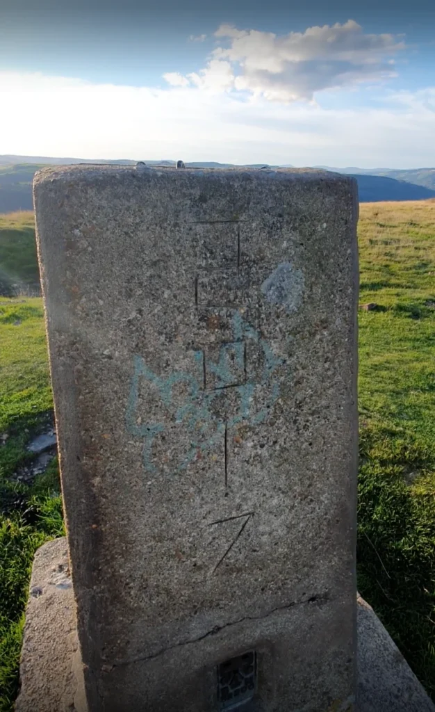
The concrete trig pillar sits on open, grassy moorland, with views across the valleys on a clear day. It can be very exposed up here, so bring a layer even if it’s warm in the village.
The loop back via St Ilan’s Church
Rather than retracing your steps, you can make a loop of it:
- From the summit, head down to Eglwysilan Road.
- Follow the road south-east for about 1.8 km across the common to St Ilan’s Church at Eglwysilan. This is a country road with no pavement, and traffic can be fast, so walk in single file, facing oncoming traffic.
- From the church, take the public footpaths west (PON 23/1, 22/1 and 22/2, the last of them a lane), which bring you back down to Dynea Road by Dynea Caravan Site.
According to Cadw, St Ilan’s was first mentioned in 1254 and stands on an even older Christian site. The churchyard is the resting place of William Edwards, who built Pontypridd’s Old Bridge.
Add Mynydd Meio
From the church, you can carry on south to the trig pillar on Mynydd Meio before heading home. It makes a longer loop of about 9 km with around 400 metres of climbing. Our guide to walking up Mynydd Meio from Rhydyfelin has the details.
Ancient monuments on the hill
The ridge is scattered with prehistoric remains, and several are protected as scheduled monuments by Cadw:
- A cross-ridge dyke, a bank and ditch about 520 metres long, beside the road south-east of the summit. No one knows exactly how old it is.
- Twyn Hywel, a dyke and cairn north of the summit.
- Garnedd Lwyd, a round cairn to the east.
- Carneddi Llwydion, a group of three Bronze Age cairns further north along the ridge.
- Prehistoric rock art: a cup-marked rock further north, scheduled in 2020.
It’s against the law to damage a scheduled monument, so please don’t move stones or add to cairns.
Before you go
- Check the weather. The top is open and exposed, and cloud and fog can come down quickly.
- Take a map and know how to use it, or a mapping app with the route downloaded.
- Wear walking boots and take water and a waterproof.
- Expect livestock. Sheep and cattle graze on the common. Keep dogs under close control.
- Watch out for vehicles on tracks. Some tracks on the ridge are byways where motor vehicles are allowed.
- Follow the Countryside Code, and take all your litter home.