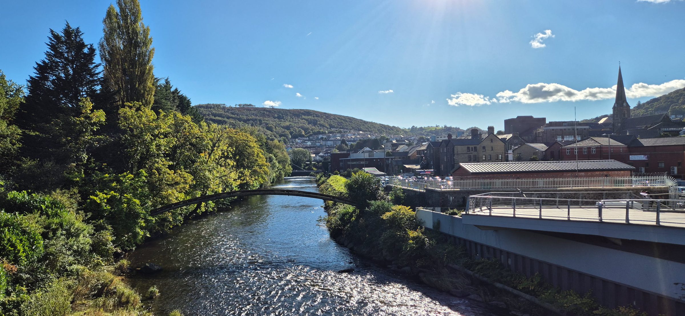
Rhydyfelin sits in the middle of the Taff valley, with Pontypridd to the north, Cardiff to the south and plenty of towns and villages within a few miles. Here’s a quick tour of the places nearby, roughly from nearest to furthest, with how to get there and what they’re known for.
Distances are approximate, by road. Bus routes and times change, so check bustimes.org(opens in a new tab) or Transport for Wales(opens in a new tab) before you travel, and see our transport guide for getting around.
Hawthorn
Hawthorn (Y Ddraenen-wen) runs on from Rhydyfelin to the south, and the lower, older part of Rhydyfelin shares a council ward with it. Together they had about 2,300 residents in 2021. Ysgol Afon Wen, the school for ages 3 to 16 that replaced Hawthorn High and Hawthorn Primary in September 2024, is on School Lane, next to Hawthorn Swimming Pool. The 132, 120 and 100 buses all pass through Hawthorn between Pontypridd and Upper Boat.
Glyntaff
Glyntaff (Glyn-taf) is next to Rhydyfelin on the north-west side, on the road into Pontypridd, and shares a council ward with upper Rhydyfelin. The University of South Wales has its Glyntaff campus here beside the River Taff, with labs and clinical simulation spaces for health and other professional courses. Glyntaff Crematorium opened in 1924, and for almost 30 years it was the only crematorium in Wales. The Taff Trail passes nearby, and the 132, 120, 100 and 102 buses stop by the campus.
Trefforest
Trefforest (Treforest in English) sits just across the River Taff. It’s home to the University of South Wales’s Treforest campus, which began as a School of Mines in 1913, so a lot of the village is students. The ward had about 5,200 residents in 2021. Trefforest station on Park Street is the closest station to much of Rhydyfelin, with trains to Pontypridd and Cardiff and a free car park, and since June 2026 the new Metro tram-trains have run through it to Cardiff Bay. Sir Tom Jones was born in the village in 1940.
Pontypridd
Pontypridd, about 2 miles north-west, is Rhydyfelin’s town, and both are part of the Pontypridd community, home to about 33,200 people in 2021. William Edwards finished the Old Bridge over the Taff in 1756, and Evan James and his son James James, from the town, wrote the Welsh national anthem, Hen Wlad Fy Nhadau, in 1856. Ynysangharad War Memorial Park is home to Lido Ponty, the National Lido of Wales. The regenerated town centre has Y Muni, YMa and, since June 2026, a riverside plaza on the old M&S site. Most buses from Rhydyfelin take 10 to 15 minutes.
Upper Boat
Upper Boat (Glan-bad) is just south of Hawthorn, about a mile and a half from Rhydyfelin by road. Its name comes from an old ferry point across the Taff, where the Upper Boat Inn now stands. It takes in part of the Treforest Industrial Estate, started in 1936 to bring jobs to the area, and has the big Tesco Extra and Midway Retail Park. BBC Wales filmed Doctor Who and Torchwood at Upper Boat Studios from 2006 to 2012. Trefforest Estate station is nearby, though its platforms are reached by stairs.
Nantgarw
Nantgarw, about 3 miles south, is a village of around 800 people with more going on around it than its size suggests. Nantgarw China Works, where William Billingsley started making porcelain in 1813, is now a museum, tearoom and working pottery. Coleg y Cymoedd’s Nantgarw campus is the college’s A-level centre, and its training restaurant and salons are open to the public. Parc Nantgarw, on the old colliery site, has the Showcase cinema. The 102 bus runs from Rhydyfelin to the college in about 15 minutes.
Church Village
Church Village (Pentre’r Eglwys) is a large village about 4 miles south-west by road, with around 6,900 people in its ward in 2021. Many people know it for the A473 Church Village bypass, opened in 2010, which takes most through traffic off the old main road. Ysgol Garth Olwg, the Welsh-medium school for ages 3 to 19 that began as Ysgol Gyfun Rhydfelen in Rhydyfelin, is on Main Road, with a lifelong learning centre and library. There’s no station, but the 100 bus from Rhydyfelin takes about 20 minutes.
Tonteg
Tonteg (Ton-teg) sits between Trefforest and Church Village, about 3 miles away by road, and had about 3,100 people in its ward in 2021. It’s mostly residential, with shops on Main Road, Gwauncelyn Primary School, and a 12th-century castle mound known locally as the Monkey Tump. Part of the Treforest Industrial Estate, around Willowford, is in Tonteg, and Trefforest Estate station is on Willowford Road. The 100 bus from Rhydyfelin and the 400 to Cardiff both stop in the village.
Llantwit Fardre
Llantwit Fardre (Llanilltud Faerdref) is about 4 miles south-west by road, just beyond Church Village. It gives its name to the community covering both villages and Tonteg, home to about 16,100 people in 2021. The name refers to St Illtud, and the Church of St Illtyd has a nave and chancel thought to date from around 1525. In the 1960s and early 1970s the village had its own car maker, Gilbern, which built more than 1,000 sports cars here. The 100 bus from Rhydyfelin stops in the village.
Cilfynydd
Cilfynydd is on the far side of Pontypridd, about 5 miles by road along the A470, and had about 2,900 people in its ward in 2021. The village grew up around the Albion Colliery, where an explosion on 23 June 1894 killed 290 men and boys. It later produced the opera singers Sir Geraint Evans and Stuart Burrows. Ysgol Bro Taf, a school for ages 3 to 16, opened on the old pit site in 2024. By bus, change in Pontypridd for the 103.
Taff’s Well
Taff’s Well (Ffynnon Taf) is about 4 miles south, down the A470 below Garth Hill, and had around 3,500 people in 2021. It takes its name from the only thermal spring in Wales, which rises in Taff’s Well Park at about 21.6°C; the well house is a listed building. Since November 2025 the village has been home to the South Wales Metro depot and control centre. Castell Coch, the Victorian Gothic castle run by Cadw, is close by in the woods above Tongwynlais. The 132 bus takes 15 to 20 minutes, or it’s a short train ride from Trefforest.
Caerphilly
Caerphilly (Caerffili) is the nearest large town to the east, about 6 miles by road, with around 33,000 people. Its castle, begun by Gilbert de Clare in 1268, is the biggest in Wales and second only to Windsor in Britain, with wide water defences and a leaning tower. The castle is closed from 30 November 2026 until Easter 2027 while its access bridge is replaced. The Stagecoach 120 runs from Rhydyfelin via Nantgarw to Caerphilly Interchange in about half an hour.
Llantrisant
Llantrisant, about 7 or 8 miles south-west by road, is where you’ll find the Royal Glamorgan Hospital, the nearest hospital with an A&E department. The 100 bus runs there directly from Rhydyfelin in about 45 minutes, through Church Village, Llantwit Fardre and Beddau. The old hilltop town has a parish church with a medieval tower, a statue of the cremation pioneer Dr William Price, and the Royal Mint Experience, with tours of the coin-making site.